Englands Rock Art Project
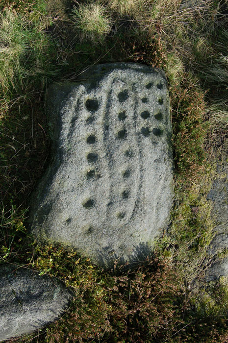
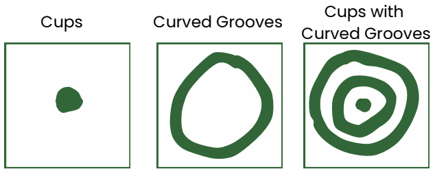
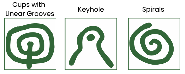
Across northern England thousands of carved symbols can be found on rocks and boulders. Their shapes range from simple circular hollows to complex combinations of cups, rings, grooves, spirals, and chevrons.
Created by Neolithic and Bronze age people who occupied the lands over four thousand years ago, their original purpose is still debated, making them one of the most interesting features of the landscape to study.
While carved in stone, rock art across the UK is deteriorating due to both human and natural threats. Therefore the accurate recording of these features is key to better understand our prehistoric past.
England’s Rock Art Project (ERA) provides an important step towards this goal of ensuring rock art is preserved digitally for future generations to research, manage, and protect the landscape. The ERA dataset was originally created as part of the Northumberland and Durham Rock Art Pilot Project which was managed by Northumberland and Durham County Councils and funded by English Heritage. This dataset has now been made available through the Archaeology Data Service.
Waypoint 1
From the start point, walk up Keighley Road. In about 20 minutes (approximately 0.75 miles), you will see a large stone cross a little way off the road to the right.
Keep on the road for another five minutes until you come to two radio masts and a gate across the road. Immediately before the gate, take a well-made path that leads east, parallel to the wall by the radio masts. After a short while, the path becomes paved.
This path crosses a very boggy area. Before the paving stones were laid, it was extremely difficult to cross, especially in wet weather. Beware that in frosty weather some of the stones may be icy and slippery.
Waypoint 2
About 15 minutes from the radio masts you come to the Thimble Stones. This is a very convenient place to sit, rest, and have a drink and a snack.
A few minutes beyond the Thimble Stones are two stones set in the ground with a poem written on them. These are ‘stanza stones’. There are a series of stanza stones with poems by Simon Armitage along the Pennine watershed from Marsden to Ilkley, connected by a long-distance walk.
Waypoint 3
A little further on is an OS trig point. Stop here and admire the magnificent views in all directions.
The trig point is believed to stand on a Neolithic burial mound. If it is a burial mound, then its location on the very highest point, with long-distance views in all directions, means that it will be the last resting place of a very important local chief or prince.
Take a moment to celebrate, as from here it is downhill nearly all the way.
Waypoint 4
The paved path carries on until you come to a boundary stone, the Lanshaw Lad, marking the division between Ilkley and Burley Moor.
The path joins a major north-south route, the Dick Hudson’s Path. Here, take a brief diversion: walk south for a short distance to the Twelve Apostles.
The origin of this Bronze Age stone circle is uncertain. It may be the remains of a burial mound. In any event, most of the stones have fallen over and been repositioned several times over the last four millennia.
Waypoint 5
Retrace your steps to the Lanshaw Lad. Carry on north, down the Dick Hudson’s Path (now paved), in the direction of Ilkley, to a small stream where the paved path ends.
Just before the paved path ends, a path forks left, over the stream and towards a small cairn on the skyline. Take this path to a second, even smaller cairn. Here, turn left, heading west-north-west.
Waypoint 6
A little further on you pass a marked depression on your right. A path crosses the one you are on. Turn left onto the crossing path and follow a faint but distinct moorland path.
At first it seems to head directly for the radio masts on the skyline, then veers to the right and carries on across the moor, crossing several very boggy patches.
Ultimately, about 30 minutes from the stream, you will see an incongruously placed park bench and, beside it, a large rock. This is the Badger Stone, one of the finest carved rocks on the moor. Its uphill side is covered with cups and rings.
We do not know whether it was all carved at one time or whether succeeding generations added their marks some 4,000 years ago. When it was carved, the whole area would have been covered by forest.
Waypoint 7
From the Badger Stone the path veers slightly to the right, gently downhill. It joins another, more major path and continues into a steep gully where it crosses several small streams that converge into an old quarry on your right.
Scramble across the streams, up the steep slope opposite, and carry on until the path meets Keighley Road. There is a culvert under the road and, on the stone entrance, you can just make out where someone carefully carved the inscription:
“Abandon hope all ye who enter here.”
Turn right and a ten-minute walk, steeply downhill, brings you back to the starting point. There is a litter bin here for your rubbish.
As you take off your boots, you can remember with satisfaction that you have crossed the highest point on the moor and, if the weather was favourable, you will have enjoyed wonderful views over most of urban West Yorkshire to the south and east, and over the Yorkshire Dales as far as the Three Peaks to the north and west.
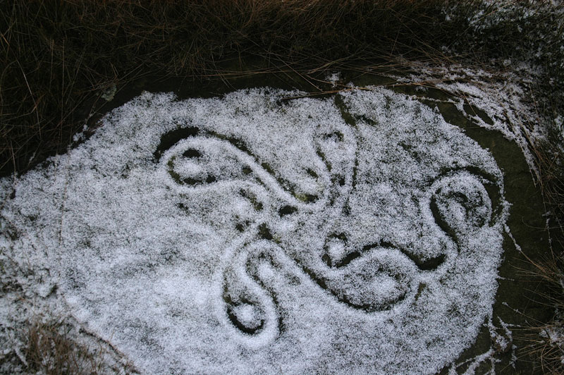
Swastika stone – Colin Williams
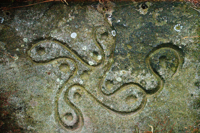
Swastika stone – Colin Williams
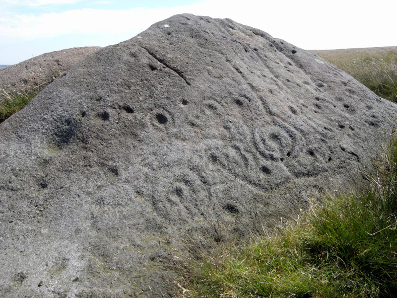
The Badger Stone – Barry Wilkinson