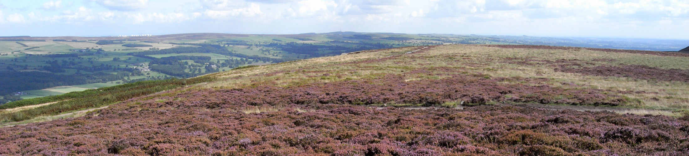
The Big Ilkley Moor Survey

Help the Friends of Ilkley Moor with valuable research, learn new skills and have fun!
Thanks to Heritage Lottery Funding the FoIM are carrying out wildlife surveys across Ilkley Moor and we would like as many people as possible to get involved. We are inviting individuals, volunteers, schools, colleges, universities, local naturalist groups, youth groups and other groups to participate in this valuable research.

Our Aims

E
To offer the local community an opportunity to explore and discover the wildlife of Ilkley Moor; and to provide training opportunities for people to learn how to carry out wildlife surveys using standardised survey methodologies.
E
To collate and collect actual biological records of this wildlife so that we gain a better understanding about Ilkley Moors’ biodiversity; this will help inform future management decisions for the moor, form a solid basis of biological data that can be used to develop projects to conserve and enhance the moor’s biodiversity.
E
To enter the wildlife records collated and collected onto the FoIM’s ArcGIS; produce spatial maps to show the distribution and extent of the habitats and species of Ilkley Moor and to analyse this data to look at the decline and/or increase in key species over time.

Training and events

Training and events are being developed and delivered to engage the local community so that people can develop skills in wildlife identification, and the surveying and recording of the habitats and species of Ilkley Moor.

The events and training are inclusive and varied to provide opportunities for all skills levels, ages and walking preferences: from strenuous to easy walking grades, and for people with push chairs or wheel chairs or people new to hill walking.

Projects for students, linked to the national curriculum or course modules are also available.

The survey also offers the local community an opportunity to learn how to record this data in the field using mobile ArcGIS apps, how to input this biological data onto ArcGIS, how to analyze this data and how to produce ArcGIS spatial maps.

Project Progress

As the project progresses, we will publish our findings, which will include spatial maps showing the moors biodiversity.

This survey is part of the Friends of Ilkley Moor ‘Nature for All’ project, funded by the Heritage Lottery fund. The second part of this project will be looking at the data that has been collated and collected and to use this to undertake habitat enhancement and management projects on Ilkley Moor.

This is a community engagement project, and the more people and groups that get involved the more data we can collect.

We have now compiled a detailed description of the work we have undertaken. This includes aerial mapping and downloadable grid maps for those undertaking survey work. In addition there is an informative Interactive GIS App.

How to Get Involved

E
Look out for the training and events in wildlife identification and wildlife surveys which form part of the FoIM’s Events and Learning Programs.
E
Every Tuesday and Saturday in September and October 2017 and 2018 Tracy Gray will be available to undertake wildlife surveys on Ilkley Moor for the local community. It is essential that people contact Tracy Gray to book onto these.
E
Visit the ‘Moors for the Future’ website to learn how to take part in Community Science Surveys on Ilkley Moor. Wildlife ID charts and survey forms are also available to download from this website.
E
Local Naturalist groups, please spend some time collecting biological records for Ilkley Moor and submit this data to either Tracy Gray or to West Yorkshire Ecology (the local biological records center).
Tracy Gray, the FoIM Project Officer, will be undertaking further wildlife surveys across Ilkley Moor, please contact Tracy Gray, Ilkley Moor Project Officer, 07780535860, tracy@ilkleymoor.org to take part in these as an individual or to discuss ways that these can fit into student projects or as part of other groups’ activities or school curriculums.